reflection and Shadow
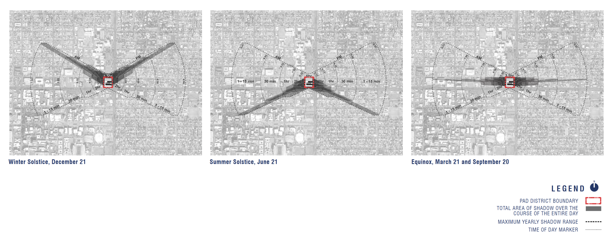
We used Google SketchUp and Rhino software to plot shadow patterns for the entire calendar year on a rectified aerial photograph. Shadow patterns were mapped for every hour, from 30 minutes after sunrise to 30 minutes before sunset. These calculations showed that the greatest shade and longest times are in the area closest to the project, which is all non-residential. Outlying neighborhoods will have the weakest shadowing and shortest duration times.
The linked simulations show how long shadows remain in each area at different times of the year. We encourage you to look at these diagrams to find your address or area of concern. In general, our shade studies show that in many residential areas, shadow from the development only occurs for a few minutes, depending on the time of the year.
The same process was used to calculate sun reflection during all seasons of the year. Additional calculations showed reflection using traditional building facades versus reflection using the proposed project façade. The building will have a double-façade design that not only protects the interior from excessive sun, but also reduces outward reflection significantly more than traditional building designs. As was the case with shadow, the most intense reflection and reflection time will be closest to the building itself, which is non-residential. Outlying neighborhoods will have the weakest reflection and shortest duration.
